
Here’s $3m RWC 2011 Walkway
That $3m Eden Park Shared Space Wairepo walkway is almost ready for prime time. And cost and disruption aside, it looks nice so far.
 The walkway is so rugby patrons can shave five minutes or so off their walking time to Eden Park for the RWC 2011 games.
 The explanation was: “The council is creating a new lane to improve pedestrian access between the city and Eden Park. The land is planned to be a shared space (low speed environment where all road users have equal priority to the road – a system which has been successful internationally) and will provide an alternative route for pedestrians, cyclists and drivers (one way only travelling around the area). For events at Eden Park, the lane is planned to be pedestrians only.”
Hopefully it will be ready for this weekend’s league game.
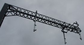
It goes straight to Eden Park at Walters Rd.
The entrance around the Trent Bray swimming pool end neat Kowhai school looks like this:

This is how it looked back in April.

How it looked in April
The houses disrupted opposite the Kingsland station and moved slightly are looking good too.
They looked like this back in January.

Houses affected are in the shadow of Eden Park
With almost all the Sandringham Rd work completed, they look now like this:


9 Comments
Looks good, however how long do you think it will take for complaints about “the tree in the middle of the road” to start popping up as drivers wanting an easy rat run get slowed down by it?
It doesn’t look like a road, Matt, so I don’t think comments like that will be common.
Also, I don’t think this is all about shaving 5 mins off - it provides a fully new route, so all things being equal, traffic halves on the other route. That’s going to be important, especially during those events when they DONT close Sandringham Road.
Further, it also cuts the distance to the train station for everyone in the area to the southeast of the train station, not just rugby patrons. If you look at the aerial, some had quite a ways around, with the new route saving 200m - if one knows that the catchment of a rail station is a 400-800m walk, that means that station has just become a lot more accessible in one direction. So that’s good too.
And just to add it on top - for the RWC walking route from the CBD to Eden Park, the reduction is more like 300-400m, and ensures that the walking route doesnt have to go through the already busy station area.
One can of course discuss whether all that was worth 3m, but I like projects like this which add more network flexibility, without ending up being just another car racecourse.
tyre marks on the nice white concrete? no thank you
Karl
the problems with thsi new road are numerous - which is why local community brd opposed it
- non game day route isn’t really shortened much at all - as peopl cut through Kowhai school
- main dangers are a new road on an arterial bend (as a rat run through to Dominion Rd), with a 100 car park for Trent Bray dwim school with 30min lessons/turn around / beside a bus stop and a school entrance. Also Sandringham cuts down from 2 to 1 lane on the brow of the bridge. So everyone just thinks this will be an incredibly danerous corner.
- could have just been walking route ie no cars/no shared space.
Also best walking route to CBD for RWC is Dominion Rd. Any major use of this creates 2-3 cross over flows of pedestrians at the Walters Rd end - again will cause issues…..
Also for games the station / steps / temp barriers all designed for feeds from Walters/southern end - so if anyone trys to use this as a short cut, it will allow them to jump to the gfront of the queue
Mark, if it turns out to be so bad as you claim, they can simply change it to a pedestrian route only. The real question then becomes how much money could have been saved in that case. I suspect some, but not the majority, not at least if you wanted a wide link rather than a narrow tunnel-type easement.
PS: Dominion Road as a walking route to RWC? How? There aren’t even any footpaths on Ian McKinnon (linking Dom Road to the CBD), and while I know Council is planning to construct them, they won’t be the kind of width for the planned walking route that thousands will take during the afternoon to filter from the CBD to the game, and then backl to the bars and hotels in the CBD again…
Jon, great photos, I went to check it out myself on the way home. I agree that it does look good, but like Chris I hope it stays that way!
Mark, your entitled to your opinion but thankfully the Auckland Councils have trained and specialist planners, designers and engineers who know what they are doing. The reasons you give are easily dismissed from what I know and have read about the project. As I understand it, in order:
- the shared space gives 24-hour access for pedestrians, through a visible and well lit safe route (rather than through a school grounds)
- let’s not forget that there were 2 intersections here previously, now combined into 1 and incidentally I counted only about 25 spaces in the swimming pool car park
- I remember this is to do with preventing crime - having cars run through at low speed discourages undesireable people from hanging around - if it were just a walkway it wouldn’t get much use late at night and attract the wrong kind of behavior.
Finally, I think you have to give a little more credit to the event planning people - i’m sure the walkway has been considered in their plans - I guess people could have jumped the queue through the school anyway
Thankfully there are some forward thinking people in Council able to develop new ideas like this for Auckland despite the nay-sayers…
@Guest Cheers!
Guest - gee you sound like a Council planner!
Trent Bray car park uses the full netball court area after 3pm and on Sat and Sunday - that’s where the 100 or so comes from.
as to designers - it had 2 “safety audits” - but second was desk top only, and they weren’t aware that trent Bray had doubled netball court area and subsequent parking and traffic movements.
And while I’m entitledd to my opinion - it was also shared by the entire Community Brd.
yes it may become a pedestrian only route - and the suspison is that Council staff knew thsi was likely - but needed to combine this with Sandringham rd to get the $7m NZTA subsidy, as individually the projects were unlikely to qualify.
So once chq is rec’d they may well go back and change from shared space to ped only - and we can only hope that there are no accidents.
I’m afraid I don’t have a lot of faith in traffic designers - the ones who gave us a controlled ped crossing on a bend - 2/3 of light chnages see cars go thru on teh red. and that’s is right alongside the entrance. there are just too many movements happening in a 50 m stretch.
If I’m wrong fine - but if there are accidents, I did my best to apply some commonsense to this……
the two entrances were better - as the exit one had a better sight line down Sandringham. Also volumes were a fraction of what they will be because it wasn’t a short cut/rat run…..
It now has cars in and out at the one point.
there are footpaths on the east side of Ian McKinnon - and as a waklking route it also can feed Ponsonby/K rd - it will also be a major taxi route - so people may be able to change their mind. it’s 1km shorter than the Bond St/Gt North rd route, and the Bond st footpath is a curved channel almost on teh other side of the NW mtwy.
In principle, the idea of dispersing people quickly from Eden Park is appealling to local residents. However, the concept of people walking up hill and down dale from the CBD and being wowed by a concrete footpath sounds ridiculous. I have walked the Eden Park to CBD route regularly and it takes at least an hour and I am young and fit. The walk is hardly going to appeal to the majority of people who can afford RWC tickets. The travel time by foot down Wairepo Swamp Walk takes approx 30 seconds - less than 1% of the total walk time from the CBD.
Further, the Council was unable to provide evidence of other shared spaces in a suburban environment therefore I can only assume that there are no such examples and probably for good reason let alone one operating in between 2 arterial roads, outside a school, a kindergarten and a swimming complex. This is a high risk solution to a simple problem of crowd dispersement. Its easy for people to comment on the impacts when it doesnt directly affect them but when my kids are put at risk I have a right to be concerned.
Also, the Councils outsourced engineering advisor are making this up as they go along and have not had the benefit of international shared space design experts. They have been caught misleading residents throughout the design period to the point where both the Council and their advisors cant be trusted. Further, the Council arbitrarily changed the design multiple times through the construction process despite making promises and commitments to local residents to mitigate some of the risks.
Matt / Karl / Guest - You might be thinking differently if you have to pick up the body of a 2 year old from underneath the front wheels of a car that is taking a ‘shortcut’