
ARC Moves On Light Rail For Auckland Waterfront
 Fantastic news! Remember the Campaign for Better Transport suggested heritage trams could run around the waterfront? Well, it’s now moving forward after a meeting today.
The Auckland Regional Council has decided to look into the feasibility of a light rail system along the waterfront to service planned waterfront developments and provide transport links to Britomart and the integrated transport services Britomart provides. It is for the waterfront area only - there are no current proposals or funding identified by the ARC for light rail as part of the wider public transport network for the city. It will report back in November.
A report to its transport and urban development committee this afternoon said a light rail facility for the waterfront development could fulfil one of the following roles:
A loop linking the development area, Quay Street and Britomart or a facility which forms part of a wider public transport solution for the city.
The report said: “Modern light rail systems are being used as part of strategic transport networks throughout the world to deliver high capacity, high frequency services largely to serve peak hour commuting trips. There are also examples of light rail systems which are limited to short loops, for example, in Christchurch. These are used predominantly by heritage vehicles and often lie wholly within city centres.”
Current planning for transport enhancements in the region and along the waterfront do not anticipate using light rail. But the committee proposed to undertake a feasibility study which will examine the potential demand for and role of light rail along the waterfront, review how light rail has been used in comparable waterfront cities and examine the potential options, implications and costings of such a system in Auckland.Planning strategies for Waterfront transport.
Below are key sections from the scoping report presented to the committee this afternoon by ARC’s John Smith, General Manager Transport and Urban Development; Martin White, Group Manager Urban Development and Jonathan Richards, Senior Policy Planner.
 The report says one of the principles of the Auckland Waterfront Vision 2040 is the requirement to ensure that passenger transport services are fully integrated into new development. Accordingly, reference is made to securing access to passenger transport facilities for new development in the Wynyard Quarter area.
The general direction of key connecting routes to serve the Wynyard Quarter area and to link it to the adjacent areas has also been identified in the Auckland Waterfront Vision. These follow Daldy Street and use the proposed Te Wero Bridge.
“It should be noted that these connecting routes have not been identified in the vision as being for public transport use; instead they represent general concepts for linkages for all forms of transport.
The vision recognises the importance of the Britomart precinct as a public transport hub which integrates rail, busway, bus and ferry services in close proximity. The vision also anticipates the continuing development of the Auckland waterfront as the primary gateway for the city and acknowledges the importance of a number of key destinations including Queens Wharf, Viaduct Harbour, the Maritime Museum and the Wynyard Quarter.”
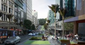
The Draft CBD Waterfront Masterplan identifies a public transport corridor suitable for a light rail system, which runs between St. Heliers and Wynyard Quarter, and between the northern end of Queens Wharf (to serve ferry terminal and cruise ship visitors) and Queen Street and Karangahape Road.
The Auckland City Council’s Central Area Access Strategy envisions that Auckland residents, workers and visitors will have access to high-quality transport choices that make it easy to move around the city centre. The strategy seeks to promote non private car use, place an emphasis on pedestrians and provide capacity and priority for public transport.
The strategy acknowledges that a Passenger Transport Integration Study is underway which will review opportunities for improved integration of passenger transport and aim to minimise the negative impact on amenity in the city centre.
The strategy specifically identifies that meeting the proposed 70 per cent non-car mode share for the Wynyard Quarter development is a priority challenge, and identifies the need to investigate the future public transport carrying requirements of the Te Wero Bridge as a high priority for action.
Plan Changes for the Wynyard Quarter development recognise the importance of public transport. The target of a 70:30 split between non-private car and private car based trips was initially identified in the Integrated Transport Assessment for the development area (see below) and the Auckland City Council (ACC) District Plan Change identifies potential routes for public transport within the quarter.
Sea + City Projects Ltd (SCPL) are currently promoting the integration of new and existing bus services into Wynyard Quarter in order to provide local (city centre) and regional connections.
There are a number of planning aspects which are being progressed – including the connection of the development area to the surrounding suburbs, the future link along the waterfront via Te Wero bridge and the future route of the third harbour crossing and a possible rail station. Auckland City Council have deferred the development of the Te Wero bridge until 2015-16 and are proposing to provide for a temporary pedestrian link in the interim.
Current planning is focused on the initial development of the Jellicoe precinct. It is anticipated that the Marine Events Centre, North Wharf and a new public open space will be completed by the Rugby World Cup in 2011 to complement the existing Auckland Fish Market. These facilities will provide a distinct destination for Aucklanders and residents and provide a catalyst for private sector commercial development and the further development of the marine and fishing industries.
ARTA business case
 ARTA have completed a draft public transport business case for the Wynyard Quarter. The work by Parson Brinkerhoff, examines the options available utilising public transport to achieve the proposed 70:30 mode split target. The business case indicates that regional public transport connections should utilise Fanshawe Street and that local bus based options could include a re-routing of the city centre free bus and extensions of existing bus routes to link the development site to the CBD and to public transport facilities at Britomart.
Overview
Whilst public transport corridors and links are being identified through these strategies and studies, the reports themselves are mostly still under development. It is notable that public transport links have been identified and are consistently represented in these studies, however, there remains a significant level of debate as to which mode of passenger transport, and which routes are to be provided in this area.
The proposed Te Wero Bridge has been identified in a range of documents as an opportunity for a pedestrian and cycle link. However, the merits of using it for public transport is unresolved, as is the type of service which would be appropriate.
Demand
An Integrated Transport Assessment (ITA) for the Wynyard Quarter redevelopment was produced by Flow Consultants in 2007. This ITA reflects the desired mode share target of a 70:30 split between non-private car and private car based trips. Further to this, the ITA identifies the following:
- Seventy per cent of trips generated by the development will be non-private car trips due to the site’s central location. A high proportion (40 per cent) of the new residents trips are expected to be made by those walking to their destination, with 13 per cent of new residents travelling via public transport.
- Most of the trips out of the site are likely to be mainly going to other points within the CBD.
- Trips to employment within the redeveloped site will be primarily from the North Shore (39 per cent) (the site’s location adjacent to the northern busway provides a high quality public transport linkage for this) or from other points in the CBD (15 per cent) with the remainder coming from throughout the region.
In relation to the proposed scope of this report, the above matters raise three questions:
- Firstly, is there sufficient demand to justify the provision of a high capacity, high frequency service such as that offered by most modern light rail schemes?
- Secondly, does the provision of public transport facilities in this location address car use, or is it providing an alternative to pedestrian and cycle trips?
- Thirdly, would a light rail link integrate with existing and proposed public transport enhancements or would it cater as a stand alone facility catering to the destination nature of the waterfront and its visitor appeal?

Light rail
Modern tram systems are largely being introduced around the world as part of cities’ strategic transport networks, delivering high capacity, high frequency services principally for peak hour commuters. However, there are a few examples of light rail systems which are limited to short loops. These are often wholly within city centres and utilise heritage tram vehicles, as in Christchurch, and Motat in Auckland.
Benefits
- Light rail schemes operate on dedicated route usually with priority measures, segregation and off highway running which allows it to move quickly through areas of traffic congestion.
- They are electric powered and clean running.
- Modern light rail systems are perceived as fast, modern and reliable and therefore more attractive to potential public transport users than buses and have proven more successful in offering a viable option to commuting by private car. A modern dedicated busway with similar off highway segregation and priority measures can deliver the same benefits at a much reduced cost, but may not have the perceived attractiveness of a modern light rail system.
- Light rail, particularly when utilising heritage vehicles, can add to the visitor experience as well as being used by city workers and residents.
Negatives
- Such schemes usually involve a high capital cost.
- Limited flexibility – the vehicle runs on rails and consequently the routes are fixed.
- A dedicated depot will be needed to house and service the vehicles. This needs to be provided at some point on the route and dependent on the number of vehicles involved, it may take a sizable area.
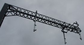
- The infrastructure generally used to deliver power to the vehicles, eg overhead wire arrangements and substations, is often considered to be visually intrusive, although alternative power arrangements are available. However, if well designed, this can become an accepted part of the built environment.
- Where the route crosses a bridge, vehicle weight needs to be considered. As it is presently proposed, Te Wero Bridge is to raise to allow boat traffic through. This raises issues of power delivery and the effects of bridge opening on route reliability.

Light rail options for the Wynyard Quarter
An assessment for feasibility of a light rail link along the waterfront will need to consider the opportunity for it to fulfil one or both of the following roles:
- A visitor focussed route linking Wynyard Quarter, Quay Street and Britomart only.
- The route along the waterfront could provide a link for visitors to destinations such as Wynyard Quarter, Britomart (Queen Street), the ferry terminals, the cruise ship terminal, and Viaduct Harbour. Consequently, there is potential for the primary function of a light rail facility, using heritage vehicles to fulfil a tourism role, which additionally also offers potential transport linkages for residents and workers. It’s potential to meet a public transport role as part of the wider network, would impact on the need for alternative funding.
- A facility which forms part of a wider public transport solution for the city.

Studies into the potential for light rail as part of the overall transport network have previously been undertaken (2002) by the ARC. Light rail was not pursued as a result, and the current main emphasis is on enhancement to the rail network and providing of integrated rail, bus and ferry services.
- A review of public transport schemes to support comparable waterfront development areas and the role of different public transport modes (including light rail schemes where appropriate).
- A review of current planning for public transport enhancement to support development of the Auckland Waterfront and an assessment of the roles of these enhancements in meeting the anticipated demand by residents, workers and visitors.
- The operational needs for any proposed light rail scheme and the ability to incorporate these in current or planned developments.
- The opportunity for light rail to support planned developments along the waterfront, to integrate with existing or planned public transport, and to allow for a step change in public transport use.
- The likely costs of a light rail scheme and the potential sources of funding.
It is anticipated that the feasibility study will be able to inform the Public Transport Integration Study currently being undertaken by Auckland City Council. The feasibility study will also assist the continued planning for the waterfront. The study will be undertaken in consultation with key stakeholders including: • SCPL, ACC, ARTA and ARC, • Campaign for Better Transport, • other waterfront stakeholders.
So progress will be reported back to the ARC Transport and Urban Development Committee in November.
Fingers crossed.


7 Comments
It is fantastic. I have ridden those trams at Motat and I can’t understand why Auckland got rid of them. Having them return to the waterfront may eventually mean people see the error of their ways and bring them back beyond just a tourist attraction around Britomart.
How romantic. I hope they have conductors dressed up in old clothes and a real old bell that rings when the tram starts.
Melbourne is a marvellous tourist holiday place and one of the attractions that has put it on the global map are the trams. Although you have reported problems with them the view from my tourist hat point of view is they are a wonderful way to see the city and get around and there is a afree tram for those travelling around the inner city which i always recommend so people get their bearings. Will this tram on the waterfront be free?
I like the photos of the Britomart development. I wandered through that area one day when nI was early for the trains and am impressed how they are keeping the historical buildings in amongst the new ones. The downtown area with its improved shops near Britomart is going to look very smart and light rail will cap it off.
A great result if goes ahead, using the old trams will be great for tourists and help Auckland get the most of the waterfront. Lets hope it happens.
Bring back the ding ding bus!
Look at the trams ( trolleys in USA ) they run down the waterfront in San Francisco.They were packed to the hilt.Get a 3 day pass for about us $18 and ride ,ride,ride to your hearts content and the cable cars,trolley buses too.