
Waterview Decisions Loom
Labour Mt Albert MP David Shearer and representatives of groups like the Mt Albert Residents Association, Friends of Oakley Creek and the Waterview Environmental Society are among those who will address a special Auckland City committee meeting on the SH20 Waterview committee on Thursday.
And the special combined meeting of the transport and arts and recreation committees of the council will seek to finally pass recommendations on ways to “move forward” on a range of mitigation actions for the extended route.
NZTA has already indicated that the following actions will form part of the project’s mitigation response:
- Hendon Park pedestrian/cycle bridge
- Cycleway from Maioro St interchange to southern portal
- Southern Oakley creek realignment and restoration planting
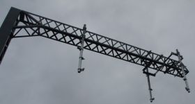
- Urban Design Panel approval of architectural treatment of ventilation stacks, buildings and noise walls
- Landscape and planting on motorway edges and stormwater ponds
- Restoration of and pedestrian access to Star Mill archaeological site
- SH16 cycleway widening
- Facilitate airspace structures at Richardson Rd bridge and allowing space at Richardson Rd to safeguard for a future rail station

Site of possible future Stoddard Rd rail station
The special joint Auckland City committee will consider endorsing the NZTA’s priorities:
Transport
- Providing for a new northbound Great North Road bus lane between Oakley Ave and Waterview interchange as part of SH20 Waterview construction
- Constructing a continuous of SH20-SH16 cycleway including bridges at Soljak Place and Phyllis St reserve
- The option of providing, or supporting the Council to provide, a pedestrian/cycle bridge over Oakley Creek between Alford St and Unitec, as an enhancement to the basic SH20-SH16 cycleway
Open Space
- NZTA to replace the loss of all open space and park land with at least an equivalent area and quality
- Replacing all Waterview open space land permanently taken by NZTA by:
- Adding approximately 0.25 hectares of open space land to Saxon Reserve
- providing approximately 1 hectare of informal active recreation open space within Waterview not immediately adjacent to the motorway or impacted by the motorway’s visual, noise or severance effects
- providing additional esplanade reserve to connect Great North Road to Waterbank Crescent
- providing additional esplanade reserve between between Howlett reserve and Alverston Street
- Expanding Phyllis Street reserve, using NZTA owned properties along Phyllis Street, to enable NZTA to upgrade the park to provide three senior soccer fields to maintain continual sports field provision prior to and throughout the motorway construction period, and to transfer this land to Council ownership following completion of the upgrades
- Maintaining the esplanade reserve along Oakley creek, and vesting additional esplanade reserve to Council from NZTA owned properties adjacent to the creek
- NZTA to provide and develop additional 3 hectares of open space land to extend the Valonia Reserve area for the purpose of a mixed-use, ecological and sports facility comprising of two senior soccer fields side by side
- Providing a new cycle and walking bridge across Oakley creek from Phyllis Street reserve to Great North Rd for the purpose of improving the Waterview community’s access to Phyllis Street reserve
Council officers say that with the upcoming change to the new Auckland Council and Auckland Transport agency, there is benefit in putting these principles in place now to avoid the need for renegotiation in the future.


0 Comments
You can be the first one to leave a comment.