
AMETI Switches To Rapid Transit
At last AMETI is starting to make sense.
The road/busway/cycling/walking and land development project in the vicinity of Glen Innes and Panmure, Mt Wellington, Pakuranga and Botany has been lingering around the old Auckland City Council for about six years and there was always a suspicion it was some sort of rejuvenation of the dreaded Banks Eastern Highway.
The project was driven by the old Auckland City Council, Manukau council and ARTA and conceived in 2005 after the failed John Banks- promoted Eastern Transport Corridor scheme – although project organisers insist this is a “completely different animal.”
Now, the new enlightened Auckland Council transport committee has this week supported upgrading AMETI to Rapid Transit (i.e. a busway rather than bus lanes).
And sources say that the Auckland Transport board has also agreed to this.
The full project is expected to cost in the order of $1.55-$1.95 billion (cost estimate as at 2010), if it provides for a rapid transit solution. The 2009 estimate of $1.36 billion was based on kerbside bus lanes.
The area has the second lowest public transport use in the region after Whangaparaoa.
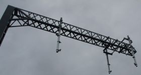
When the Auckland Transport first presented to locals the concept in December, the image showed dedicated bus lanes along Ti Rakau Drive and a section of Pakuranga Road as part of a busway that will eventually run from Botany to Panmure train station.
The bus lanes would allow for up to 60 buses an hour between Pakuranga and Panmure.
It would be developed in stages, based on demand, with the first stages between Panmure and Pakuranga town centre. It will then be created in stages along Ti Rakau Drive towards Botany.
These were the original designs put out to residents by AT:


Central bus lane concept | Auckland Transport
At its Christmas board meeting, Auckland Transport CEO David Warburton talked of faster timelines emerging. At this stage, completion of the full project is expected by 2033.
He said this was a good example of how the new Auckland Transport model could best work as a “one (transport) network approach” including involving NZTA (instead of working through the old cluster of local bodies and transport -related bodies).
And Auckland Transport chair Mark Ford said he was very enthusiastic about the Pakuranga busway plan and that this south-east area of Auckland was “badly disenfranchised” when it came to public transport.
Auckland Transport council-appointed director Mike Lee told that meeting he supported the busway concept but spoke for a number of us when he noted that he has been “singularly unimpressed” with progress so far on the project from his observations from a distance.
“We have to move on it now. The consultants have made enough out of it in the last six years and it’s now time to do something tangible,” he told the meeting.
Auckland Transport is now project-managing AMETI, in collaboration with Auckland Council. NZTA is involved in terms of tie-ins to the state highway network and also as a funding provider.
Under the old Council, in 2009, AMETI, was divided into 6 packages of work. The timelines below are as of 2009 but the costs are as of 2010:
- Panmure Corridor (construct 2011-2019) $625m - $810m
- Sylvia Park bus lanes (construct 2011-2012) $17m - $21m
- Pakuranga interim provements (construct 2011) $2m
- Pakuranga, Ti Rakau & Reeves (construct 2015-2021) $445m - $520m
- Transport modelling (2010-2014+) incorporated in the project costs above
- Mt Wellington area investigations (designation 2012-2015)
Construction of package 1, the Panmure section, is expected to commence sometime this year. Other packages of work are at various stages of investigation and design, through a managed process.
The Panmure section comprises:
- A new road between Mt Wellington Highway and Merton Road. It is in trench alongside the rail line near Panmure, to minimise severance.
- A new road between Stonefields (Mt Wellington Quarry redevelopment) and Pilkington Road.
- Interchange between the rail station and town centre with at grade bridging to mitigate existing severance (referred to as a Transit Orientated Development).
- Improvements to the transport interchange to facilitate bus transfers.
- Implementing bus priorities along Ellerslie Panmure Highway, Lagoon Drive, Panmure Bridge and Pakuranga Highway.
- Improved and new cycling and walking facilities.
- Realignment and changes to Panmure roundabout, which will facilitate pedestrian access between Panmure town centre and the transport interchange.
- Retention of views between town centre and Maungarei/Mt Wellington.

Panmure interchange


AMETI’s stated aims say they are to achieve these benefits:
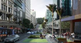
- Residential intensification in the Tamaki Edge area, which is expected to double between 2001 and 2030.
- There are also significant growth opportunities around Botany, with Flat Bush town centre and residential development.
- Employment is expected to nearly triple between 2001 and 2030. There will be capacity for approximately 40,000 new jobs on land opened up by AMETI and for developments already planned in AMETI area.
- Improving access to and around the Tamaki Transformation Programme.
- Providing access to key development areas beyond the Tamaki Transformation Area i.e. Panmure and Glen Innes growth centres and East Tamaki, Mt Wellington and Sylvia Park employment centres.
- Opportunities to connect communities and provide better links to public transport and local facilities. • Improvements in travel times, safety, and access for motor vehicles, buses, cyclists and pedestrians.
- Contribution to the quality transit network route and rapid transit network route, with future
- The stated downsides: The project will impact on the surrounding landscape and communities. A report to this weeks Council committee states:”Briefly, these impacts range from changes to existing road layouts and access, the potential for AMETI to further sever existing communities in places where widening or new crossings occur, potential visual impacts, as well as other effects related to roadbuilding. Auckland Council officers are currently working closely with Auckland Transport on these matters.”


8 Comments
Why not surprise everyone and put lightrail or Tram-Train lines down instead of a busway?
60 buses per hour equals about 20 tram-trains.
At the Transport Commitee meeting, the Auckland Transport representative stated the bus way would not be in the centre, but a two laned busway would run on the right side of the road [eastern side] through the Panmure section.
@Thanks Jonathan. I have clarified that those were the original designs AT had handed out to residents.
AKT - You are still correct, the plan is for the busway on the right hand side from the Panmure bridge through to the train station but down Ti Rakau Dr AT were looking at either centre bus lanes or only one one side with their preference for centre lanes as it avoids issues with property access.
My understanding is that the centre busway is for along Ti Rakau Drive whereas the side busway is around Panmure.
Can’t the ball start rolling by painting the outside lanes of the Pakuranga highway and turning these into bus lanes? No passenger cars can use the lanes in peak periods? Run this all the way to Bleakhouse road intersection. That wouldn’t take much at all would it? (Have a switchable peak dedicated bus lane on the Panmure bridge).
This could also go to Botany (a seperate route)
And also Cascades road / Millhouse / Meadowlands Drive (a seperate route but would require work on the Millhouse / Botany interesection city bound)
This should run all the way to a stop on the Panmure Bridge (to drop off / pick up passengers for the train) and onto Ellerslie (to drop off / pick up passengers for the train) by bus lanes on the highway.
Would this cost a lot?
I would much prefer to see trams or a busway but the above could be done quite quickly and get people out of cars.
DanC - my worry would be that implementing your proposal (taking away current traffic lanes for bus lanes) would create such an enormous backlash in the area that it would make the Dominion Road and Remuera Road stouches look tame.
Sadly, in this part of Auckland, we barely have an acceptance that PT SHOULD serve them. To sacrifice car lanes would be unthinkable. So we are stuck with a very expensive AMETI scheme that tries (nowadays) very hard to improve PT without sacrificing car space (or in some areas, actually spends lots of money on car space).
Horse for courses - a quick job would only fail horribly here, I am afraid.
Please, please call them RAILWAY STATIONS and not that dreadful; Americanism Train Stations!!!! Railway Stations always used to be the norm - what has happened?